The National Weather Service is conducting preliminary assessments of storm damage across Alabama following Wednesday night’s severe weather, when a line of severe thunderstorms moved across the state overnight. As of Thursday night, NWS has confirmed that Perry County saw at least two tornadoes resulting form the storm. Both confirmed tornadoes have been classified as EF-2, and both appear to have formed as the result of a “supercell” storm that passed through Perry County.
The first of the tornadoes to form was at around 9:33 p.m. southeast of Marion.
“The tornado began along Dr. J.J. Howard Road, where a path of trees were snapped and uprooted [on] either side of farmland,” said a Public Information Statement on the storm released by NWS Birmingham on Thursday. “Additional trees were snapped and uprooted along Albert Turner, Sr. Memorial Highway, where a residence escaped any significant damage despite significant surrounding timber damage.”
“The most significant damage occurred along Fikes Ferry Road, where a swath of pine trees were snapped, pushing the rating to EF-2. The tornado continued northeastward, coming to an end before reaching Highway 14 just north of Radford.” The Fikes Ferry Road Tornado, as NWS documents referred to it, lasted less than ten minutes, ending at 9:41 p.m.
NWS’s field team estimated the peak length of that tornado’s track at around six miles and its maximum width at 620 yards. Its estimated peak wind was 115 miles per hour.
The second tornado confirmed in Perry County by NWS had a much longer track, affecting Perry, Bibb, and Shelby Counties. It was estimated to have begun at around 9:53 p.m. near the intersection of Highway 219 and Highway 183 near Adler.
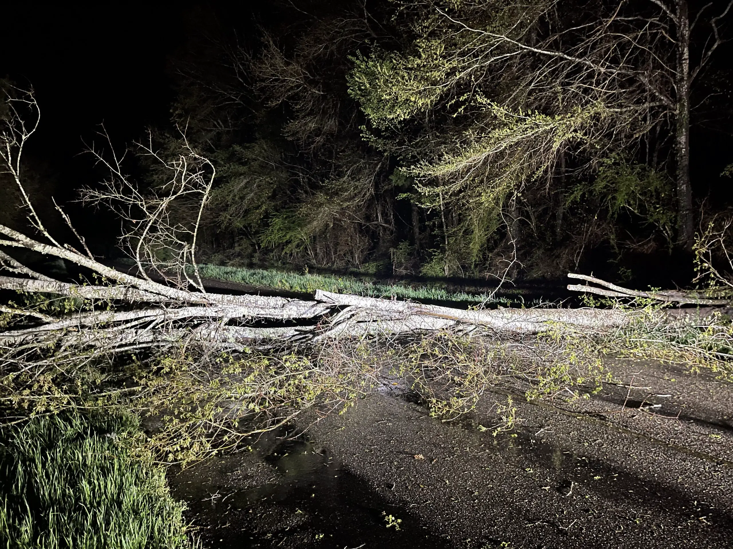
NWS field surveys noted tree damage along Barnette Cemetery Rd. and Whitetail Rd.
“Several camper units belonging to a hunting club were also rolled or destroyed with debris blown downwind.”
“The tornado continued northeastward, causing additional timber damage…a few residences had damage either caused directly by wind or fallen trees.”
That tornado traveled through Bibb County, with a path of trees uprooted and snapped over a half mile wide south of U.S. Highway 82 near Trio.
It entered Shelby County, where more damage to homes resulted from fallen trees. The storm damaged buildings in Montevallo, even some buildings on the campus of the University of Montevallo, before dissipating.
NWS also classified that tornado as an EF-2 and estimated that it had a peak length of 29.46 miles and a maximum width of 800 yards. There were at least two recorded injuries associated with the storm, although the NWS statement does not specify where those injuries occurred. The tornado lasted nearly 30 minutes, forming in east Perry County at around 9:53 p.m. and dissipating over Montevallo at 10:24 p.m. It had estimated maximum wind speeds of 120 miles per hour.