Perry County Courthouse will be closed at noon and the Perry County Commission meeting scheduled for Tuesday night, March 22 has been canceled, said Perry County Commission Chairman Albert Turner Jr. on Monday night.
“I pray that our county will be spared any damage,” said Turner in the announcement.
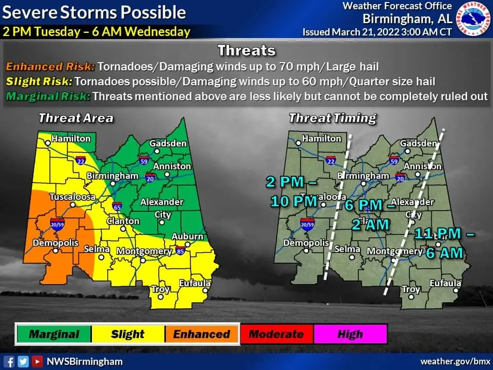
The National Weather Service’s Birmingham office released information throughout the day Monday outlining the potential severe weather threat for Tuesday. By Monday evening, NWS had placed Perry County in an area of “enhanced risk” from the storm.
Computer models predict the storm will travel through west central Alabama Tuesday afternoon through evening. The worst parts of the storm are predicted to pass through Perry County from 2:00 to 6:00 p.m. Supercells ahead of the main storm system may start to form in the area at around 4:00 p.m. NWS says this storm could produce tornadic activity in Alabama.
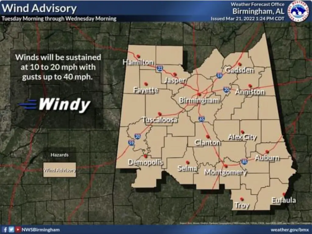
NWS has placed Perry County under a wind advisory from Tuesday through Wednesday morning, with gusts of up to 40 miles per hour possible.
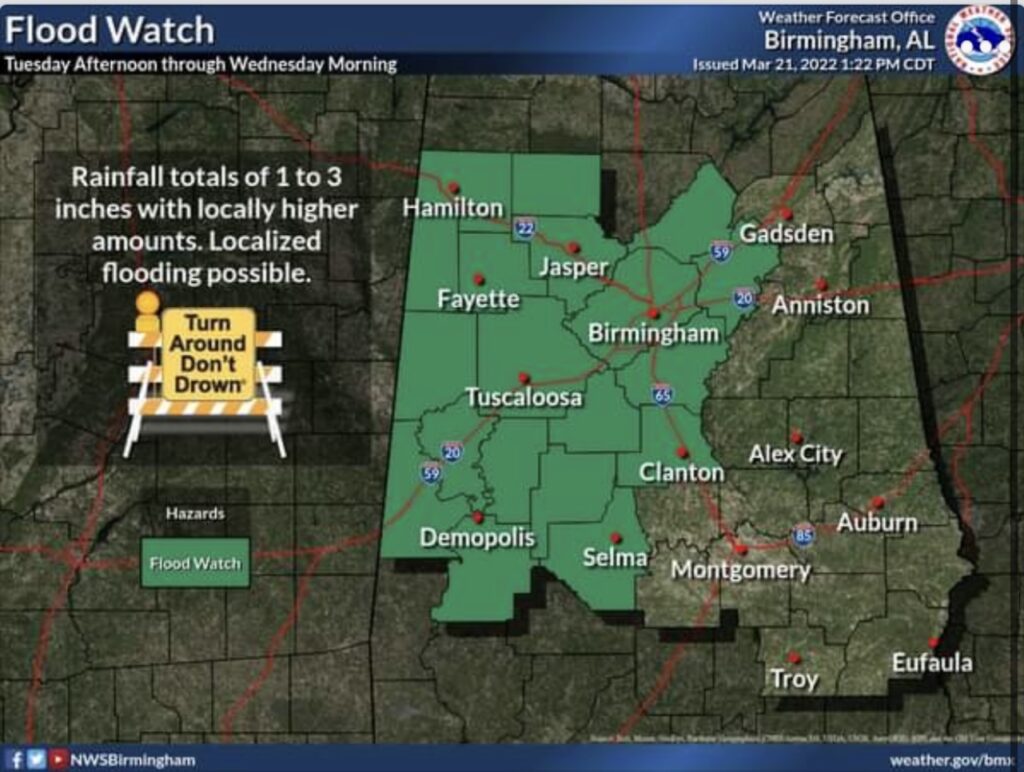
The agency has also issued a flood watch including Perry County. Rainfall with a total of 1 to 3 inches in the area could bring flooding throughout West Alabama.
In response, some area offices and businesses announced closures ahead of the storm. Schools in Marion and Uniontown are closed for Spring Break this week.