Alabama, and particularly the Black Belt, may see more severe weather on Tuesday morning, April 5, as a line of thunderstorms makes its way across the state. National Weather Service’s Birmingham office says parts of Perry County could potentially see damaging straight-line winds, and that hail and tornadoes are also possible.
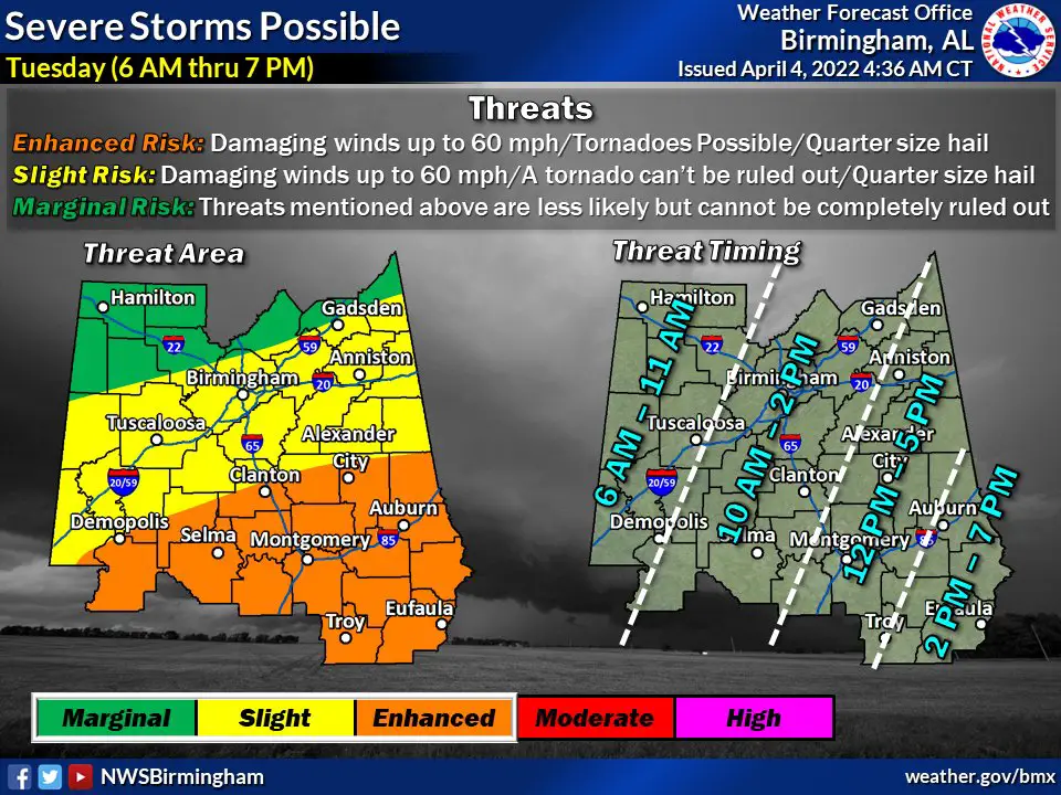
“A large area of rain and thunderstorms will enter the western portions of the state between 5-7 am Tuesday,” said Alabama Emergency Management Agency Meterologist Jim Stefkovich in a release on Monday. Stefkovich said there was the potential for individual supercell storms to develop ahead of the main storm system. This potential is concentrated in the southern half of the state, and the Black Belt is forecast to be in a zone of “Enhanced” risk for severe weather.
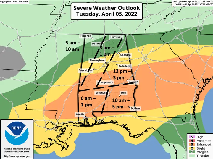
Forecasts from NOAA and from the National Weather Service Birmingham office differ on when the storms may move into our area: NOAA’s map shows storms passing through Hale and Perry counties between 8:00 a.m. and 1:00 p.m. on Tuesday. The NWS Birmingham map suggests storms could enter western Hale as early as 6:00 a.m. and Perry County as late as 10:00 a.m. The storms are forecast to break up as they move eastward across the state.
“Damaging straight-line winds, hail to golf ball size, and a few tornadoes are all possible,” said Stefkovich. “In addition, latest model date indicates that a couple of strong tornadoes (EF2 or greater) are possible south of a Livingston – Montgomery – Auburn line.”
Thunderstorms crossing the state last week generated multiple tornadoes in the Black Belt, including two in Perry County and one that devastated the historic downtown of Faunsdale in north Marengo County, near the Hale County line.
Wednesday to bring more storms
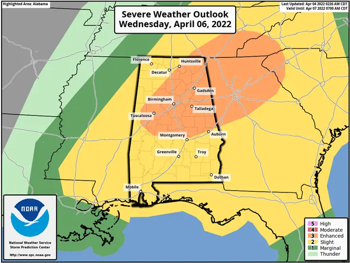
Tuesday’s storm system won’t be the last of potentially severe weather for the area this week. More storms are forecast to be headed for the Black Belt, and the rest of Alabama, on Wednesday afternoon. Hale and Perry Counties are both placed in an area of “Enhanced” risk in preliminary forecasts for that day.
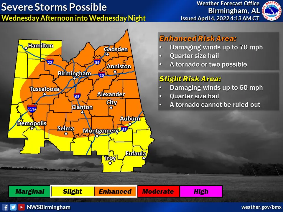
“A line of thunderstorms is forecast to develop ahead of a strong cold front on Wednesday, entering the northwest portions of the state after 12 pm, move southeast and exit the southeast sections of Alabama between 2 am – 6 am Thursday. Confidence has increased since yesterday in severe weather occurring with this system,” said Stefkovich. “Damaging straight-line wind gusts and large hail are the primary threats. A couple of embedded tornadoes are also possible within the line. A quick 0.5 – 1.5 inches of rain is expected, but additional flash flooding does not appear likely, or isolated at best.”